Mount Albert Edward: An Adventure
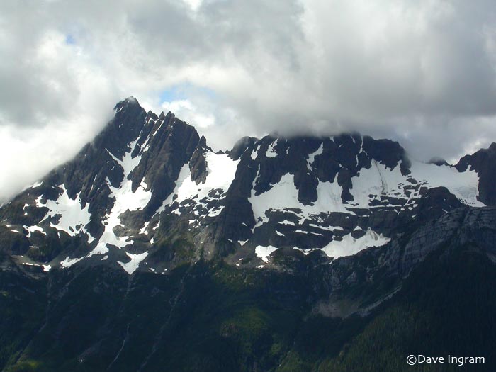
Cover Photo (from Web). No this is not Mount Albert Edward, this is the Golden Hind, viewed from Morrison Spire (photo by Dave Ingram). The Golden Hind, at 2200 meters (7217 feet), is the highest peak on Vancouver Island. This photo is placed here as it will serve as a challenge to Dianne and Michel who will surely stand on that peak in the not to distant future. Perhaps, just perhaps, I shall stand with them. The mountain we set about to challenge on this trip is the somewhat lessor (although not by much) Mount Albert Edward. a respectable 2100 meters (6900 feet). The twists and turns of the trip are documented in this short story of our three days in Strathcona Park.
Link Here for the Mount Colonel Foster Adventure
I am most fortunate to live within an extended family whose quest for adventure has motivated me in every decade of my life. In the recent decade, since joining Facebook, never a week goes by that the details of new adventure by some family member or friend is posted. It is the posts about real life experiences and adventures that serve as constant motivation too challenge life at every turn, not the memes and platitudes that seem to come with such frequency.
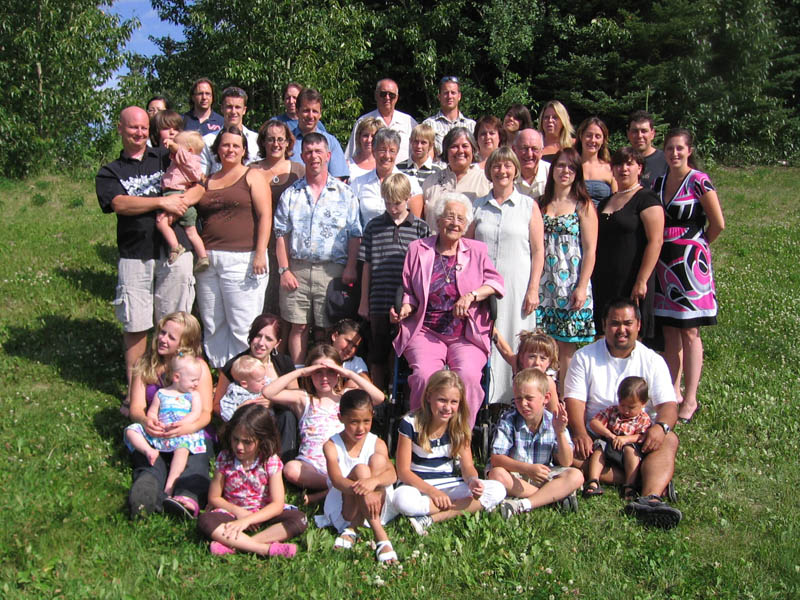
Photo (family files): This 2008 Family Photograph taken at our mom’s 90th Birthday Party. It shows many of the adventurous persons within our immediate family. (Link here for names)
After looking at the photographs that sister Dianne and her partner Michel posted of their adventure filled hike to Mount Colonel Foster in Strathcona Park, I realized it had been a long time since I faced the challenge of a long wilderness hike, the last being the West Coast Trail with our daughter Kari. While the West Coast Trail did not involve a mountain climb, it was still a challenging eighty kilometers from Port Renfrew to Bamfield along the rugged West Coast of Vancouver Island.
When Dianne said she and Michel were going to challenge Mount Albert Edward and asked if Lynn and I would like to accompany them, my first response was one of trepidation. While I am in fairly good shape, the aches and pains that come with being a septuagenarian are clearly evident, particularly when climbing out of bed in the morning to say nothing of that which might become evident when climbing a mountain.
When I checked in with Lynn (thinking she might have already made commitments in her busy life) she simply said: ‘Sure, let’s do it.’ Damn woman, always so eager! The die was cast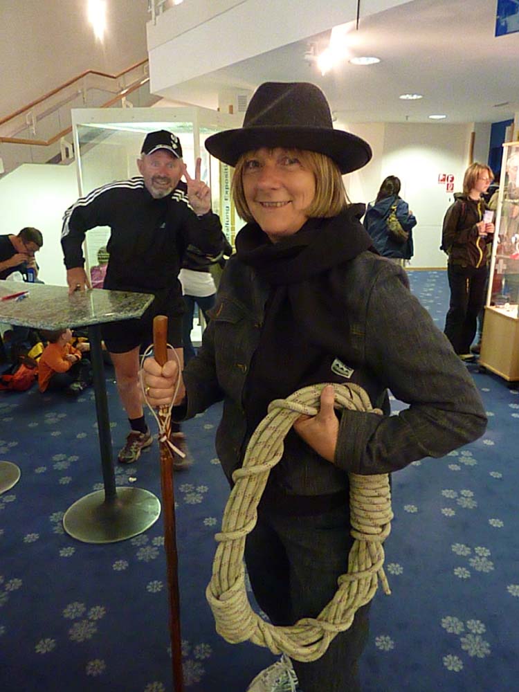 as there would be no way of gracefully backing away once the commitment was made.
Now, a word about my youngest sister and her partner. The couple has, with the able assistance of their youngest daughter, a health and fitness guru, taken some amazing steps to rejuvenate their bodies over the past several months. A forty kilometer, three day trek, including a rather challenging mountain climb, would be a test that was easily within their new-found limits. For Harold it was an open question.
Photo (file 2009): Lynn collects her gear for an assault on the Jungfraujoch peak in Switzerland.
Link here for the story.
As fate would have it, things did not proceed exactly as planned. Three day’s before our departure, Lynn contacted a rather nasty eye infection that was going to sideline her for several days. When I told Lynn I too would call off the trek, she simply said: “No way Jose, it will be good for you to get away with your sister for a few days.”
Sure, I thought, to a beach in Mexico or perhaps, a cruise on the Med, but a three day, 40 kilometer trek and mountain climb might be stretching things. I also think Lynn had forgotten that little canoe trip from ‘hell’ with Dianne and Michel that was very nearly our last. Two day’s later found me driving to Campbell River. I find Lynn to be a very powerful source of motivation.
My packing had been haphazard at best as it was not until the last moment that I decided to go. While I did manage to find some of my old trekking gear (including the trusty trail boots) I decided to use my travel backpack which was decidedly unsuited to back country trekking. Dianne and Michel, on the other hand, have purchased quality backpacks that provide a balanced weight distribution.
It helped that Dianne and Michel had made arrangements to access to a privately owned A-frame at Moat Lake, about two kilometers beyond the Circlet Lake campground and the trailhead to Mount Edward Albert. This negated the necessity of packing a tent, sleeping bags and cooking gear. Di and Mic expected it would take about five hours for the 12 kilometer hike, the speed of which, I suppose was to be defined by the ‘old timer’ in the group.
As Dianne and Michel had covered off most of the food supplies, I was left with a pack of about twenty pounds (age has it privileges), while they each carried thirty. The early forecast was for clear skies, but when Michel, a water taxi operator along the West Coast who keeps a close eye on such things, picked up a forecast for Sunday that suggested things might turn nasty.
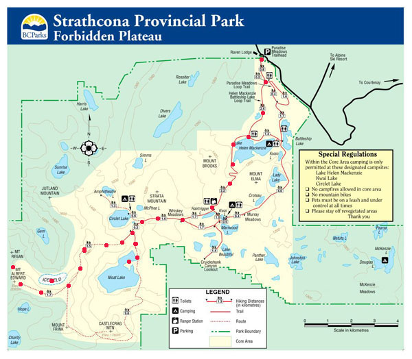
Chart: The red dotes indicate the route taken to Moat Lake
and then to Mount Albert Edward.
Packed and ready to go at 10:30 am, it was a glorious West Coast Saturday morning that found us on the trail to Moat Lake as Mount Albert Edward beckoned in the distance.
Day 1: Mount Washington to Moat Lakk
I felt great, but it was a challenge trying to keep pace with Dianne and Michel, for it was like trying to control a team of horses that had eaten too many oats for breakfast. As nephew Stephen Yochim (when he was younger of course) was fond of saying: “Whoa Nelly.” That was Dianne and Michel.
It helped the first 3.5 kilometers, to Lake Helen Mackenzie, was easy going as it was smooth gravel with large sections of marshland covered by boardwalk used to protect the fragile ecosystems in this high traffic area that attracted hundreds of summer, day hikers. After a brief stop at the lake, we collected a batch of friendly Whiskey Jacks and took the northern Mount Brooks route.
Photo: Dianne gazes at one of the dozens of small mountain lakes that dot this amazingly beautiful area..
The trail then began to rise in a manner not unlike that which you might find at any of the many moderate trails in Goldstream Park and over the next 1.5 kilometers, we gained altitude at a brisk, but manageable rate, As we trekked past the southern slope of Mount Alan Brooks (1500 meters (5000 feet), we then dropped back down toward Hairtrigger Lake which sits at 1200 meters (4000 feet). This climb, then drop would be repeated several times as we headed for Circlet Lake, the overnight camp spot at which most hikers heading for Albert Edward, spent the night.
About half way to Circlet Lake we entered Whiskey Meadows, a high alpine area that presents the hiker with stunning beauty that would be be ever changing throughout the various seasons of the year. For cross country skiers and snowshoers this area must be a delight. It crossed my mind the meadowns might be named after our now constant trekking companions who still 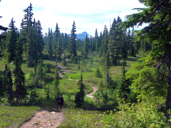 looking for handouts.
Photo (left)): Dianne hikes into Whiskey Meadows. In the distance, centre top, we begin to see the outline of Albert Edward. It does seem there is yet a long distance to travel even though we are now at the half way mark of our trek.
Midway through the meadown, Parks BC has built a Ranger Station to house the staff needed to provide emergency assistance and exercise some control over hikers who may think the next best thing to trekking is an all night campground party. Just beyond, Whiskey Meadows we caught our first glimpse of the Castle Crag, Frink and Albert Edward Mountains which, in my opinion, seemed to be sitting on a far too distant horizon.
Albert Edward and the other mountains are all part of the ‘Insular Belt’ that extends from Vancouver Island, through the Queen Charlottes (Haidi Gwai) and into the Alaska Panhandle. The range is continuous, although large sections sit hundreds of meters beneath the waters of the Pacific Ocean. It is strange to think of mountains the size of Albert Edward sitting on the ocean floor completely covered with water. It is also strange to think these same mountains, less than 12000 years ago, were buried in hundreds of feet of ice during the last glacial 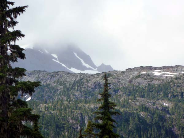 period.
Climate Note: The earth certainly does go through amazing frequent cycles of warming and cooling. The next thing you know, we could be into a period of accelerated warming that could very well melt the last of that ice remaining at the North and South Poles (Reference Chapter 5 of Pax Canadiana).
The first European sighting of this range was likely by Sir Francis Drake in his vessel the Golden Hind (hence the name of the largest peak in the range) sometime around 1579. For an excellent historical read of the discovery on North America, you might wish to check out The Secret Voyage of Sir Francis Drake, by a Victoria businessman, politician and author, Samual Bawlf.
At the 10 kilometer mark we reached Circlet Lake, the cutoff point to Mount Albert Edward and the continuing the loop to Mount Frink and Castle Crag Mountains, the three mountains that would become our neighbors later in the day. Even from a half a kilometer back, it was evident the cliffs on the west side of Circulet would rise almost vertically toward the ridge trail that lead to the summit of Albert Edward. It promised to be a rather challenging climb.
After passing Circlet Lake, we soon reached the final cutoff to Albert Edward, then branched southwest onto a little used trail that lead to our destination at Moat Lake. While I was feeling 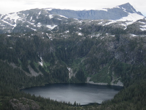 tired, but good, I made mention to Michel that I hoped this final section would remain as flat as the first half a kilometer suggested. All Michel, a man of few words, had to say was, ‘perhaps’.
Photo (Web): The trail on which we hiked, trailed off west to the left and out of the picture. The cut-off to Mount Albert Edward (peak at top right), climbed steadly up the rapidly rising ridge you see in the background. Moat Lake sits to the left on the other side of this ridge to the left.
You guessed it. Not more than two hundred meters later, we branched west and started a measured rock climb that took us up 200 meters to a table top outcropping the provided a stunning view of the valley’s to the south. The cliffs must have dropped off a 2000 feet to the valley below.
As few hikers use this route (I think it is a dead end) and much of the trail is over bare rock, the route is defined by small rock cairns. After less than two hundred meters of flat surface it was down again, then back up. And so it went until I suggested to Michel we stop for water as my three litre supply was long gone on this very hot day (26C). After a short rest while Michel filtered some water from a crystal clear, mountain pond, we were back on the trail.
After having made our first sighting of Moat Lake and climbing down toward what appeared to be a creek with a rudimentary bridge, we discovered we had missed the proper cutoff. While it was just a short climb back up, after putting in a good 12 kilometers over six hours, I was certainly ready to call it quits for the day. Dianne and Michel, on the other hand, were ready for another five, perhaps ten kilometers. I resolved to cut back on their oats.
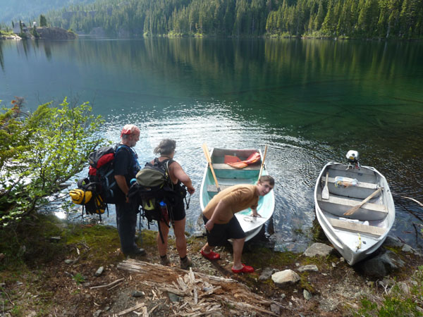 At the lake, we were greeted by a young man, Joe Harper, in his mid-teens, an effervescent teenager who heaved our gear into the two boats (he had towed one over from the cabin), we shoved off and headed toward the Island camp. While Dianne and Michel rowed one boat (they were still working off breakfast) Joe and I used the power boat. As soon as I had climbed in the boat Joe looked at me and said: “I know you don’t I?” It was strange that he should say that, for as soon as I met him at the lake I had this odd feeling I had met him before.
On the way across the bay, Joe and I explored various possibilities, but nothing connected. It was complicated as Joe had only arrived in Canada with his family five years earlier from Lincolnshire, England, and had only lived only in the Upper Island. The chances of our having met seemed limited so we decided that after the trek we would join up on Facebook and see if something (or someone amongst our friends) might trigger one of our memories.
At the camp we met another delightful young man, Clinton Wood, who was son of one of the owners of the historic campsite that has been in the family for over 100 years. Between Clinton and Joe we were the ropes of using the site and how to shut it down as both boys were leaving the next day while we were away at Albert Edward. As you can see in the attached photos, the wilderness campsite must have provided countless hours of serenity to the family and friends of the Wood’s family.
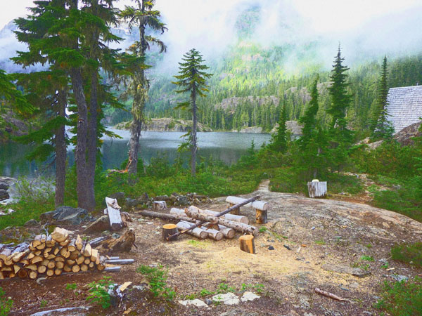
Photo: View across the camp grounds and Moat Lake towards the cloud shrouded base of
Albert Edward. Our cabin sits to the far right. Could it be more idylic? I think not.
As soon as the sun had set over the mountain and darkness began to fall, we settled in for well deserved rest. Di and Mic retired to an air mattress in the loft, while I took the one of the two single bunks on the main floor. Within minutes the three of us were sound asleep.
Link here for photographs of Day 1
Day 2: Mount Albert Edward: An Alternate Route
It was not long after midnight that I heard someone mutter something suspiciously like “sacré bleu”, then the sound of a manual air mattress pump being operated by a shadowy figure kneeling in the darkness of the loft. Five minutes later all was quiet and cabin regained that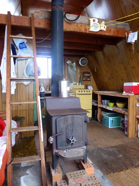 absolute still that can only exist in the wilderness. Ninety minutes later more muttering along with the sound of the pump, then quiet until 3:00 am.
At that time, as Michel pumped and issued barely audible curses, I could see Dianne, her little head lamp attached to her forehead, climbing down the stairs to main floor. She sleepily threw around some blankets, climbed into the bunk that lined the wall in a horizontal line with mine and all went quiet.
I expected Di and I would be toe to toe, but when I my toes creeped out from under my blanket and became entangled in hair, I realized she had slept the other way around. Why? Well, she told me later, she did not want to sleep with her head tucked under shelving that protruded over the other end, as she knew for certain that if she jumped up in the night she would most certainly knock herself out. OK, sounds reasonable to me, the alternative was smelling my stinky, sweaty trekking feet.
About 7:30, I opened my eyes and when I glanced out the floor to ceiling at my head, I knew everything I needed to know about the weather. Heavy drifting fog or low cloud shrouded the lake and nearby mountains. The drafts that penetrated the cabin told me the temperature had dropped to at least 12C. While it might be a typical west coast morning fog that burns off by mid-morning to noon, I had the distinct feeling this was going to last all day. While it was not yet raining, it seemed likely this would be in the offering as predicted by Michel’s earlier 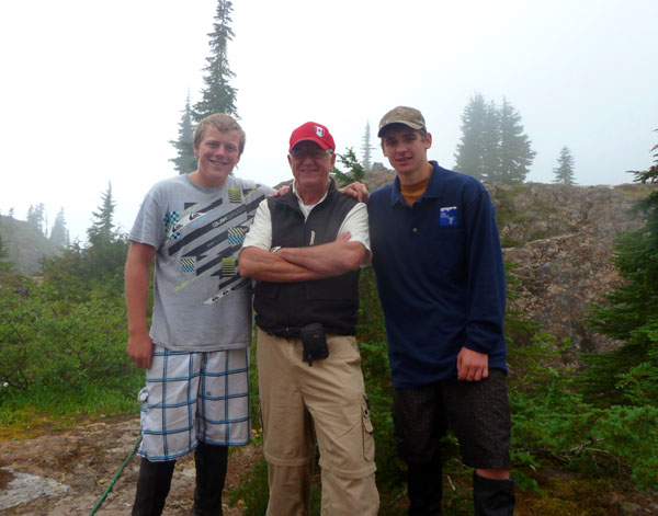 forecast.
After a quick trip outside, I could noted the boys were already up in the other cabin, had a fire going and most likely had water boiling. We were invited over to make coffee and breakfast.
Photo: During slight breaks in the overcast I managed to catch a few photos around the camp. Here I am joined by Clinton (left) and Joe.
The boys suggested the 15-16 kilometer return trek to peak of Albert Edward might take four to five hours. For Joe and Clinton, for sure! For Dianne and Michel, perhaps! For me, no way! Even for Dianne and Michel, I thought a 8 kilometer climb to the top, then descent, might take six to seven hours assuming no problems. Given the weather, I that I felt was an overly generous estimate.
The previous evening I had looked north toward the ridge that led to Albert Edward and suggested to Michel that one might tackle the mountain from a wedge that rose northward between Mount Albert Edward and Frink. By taking that route, one could join the trail that led to the peak of Albert Edward – a total distance of perhaps three kilometers, of which two kilometers would be a rather tough climb through uncharted territory. It seemed the reason this route was never explored is that it required a boat to cross Moat Lake as the steep cliffs around three sides of the lake prevented access. As we had access to the boat, it seemed that
As far as the standard route from Moa to to Circlet Lake then to Albert Edward (reference chart in Day 1), given the aches and pains I suffered during the previous days trek in ideal weather, I doubted I was up for the 16 kilometer return trek in poor weather and a climb that would see an elevation change of more than twice that which we had already experienced. I felt, at best, I would slow down Dianne and Michel as they took a shot at the peak and, at worst, if I decided to turn back, it was doubtful they would be willing to let me return on my own.
The alternative, I suggested, would be for me to talk to Joe and Clinton to see if one of them might accompany me to the north shore of Moat to check out the slide chute for a possible route to the top. It was agreed.
By 08:00 am Di and Mic were packed with basic survival gear in case they became trapped on the mountain and by 8:30 they were well on their way. Twenty minutes later Joe and I boarded the boat and headed toward the north shore of Moat.
In the slide chute above the first ice fall, visibility was almost zero and in the light rain that had been falling, exceedingly slippery. I imagined the conditions for Di and Mic would be very 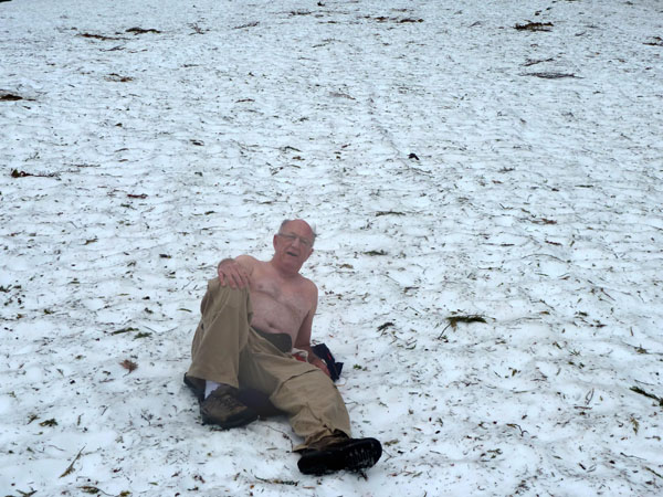 similar except for having a well defined path. As Joe and I explored the higher elevation, I was able to capture some photographs during breaks in the fog. It was a wonderful but rough area in which a snow and rock slide must have occurred some time within the past few years. There was a lot of loose, broken shale and Joe had pointed out were several large boulders had come tumbling down the mountainside into the lake.
Photo: For a Vladmir Putin type PR photo, I slipped off my jacket and sweater for a climbing pose on Albert Edward.
Following a couple hours exploring the wedge and ice fall, the fog closed in again so we headed back to the lake as Joe wanted to show me one of the mountain streams coming off Mount Frink where they picked up fresh water for the campsite. Joe also told me that as very few people fished the lake, it had large population of trout some of which would gather in pools at the base of the mountain streams that feed the lake.
He then suggested he may be able to catch one by hand just as do the black bears. Given this young fellow had only emmigrated from the ‘wilds’ of England a few years earlier, I was skeptical that he had acquired the fishing skills of a black bear or grizzly. Low and behold, it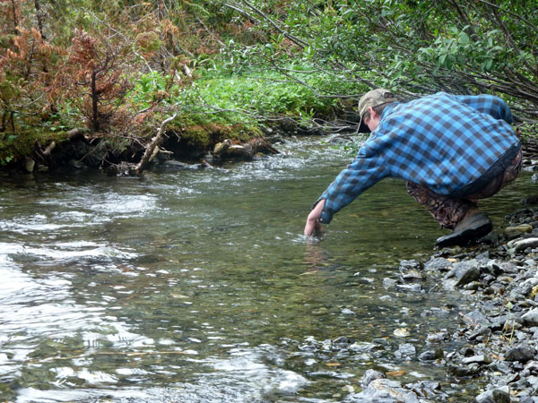 was not long before Joe snagged a rather good sized trout. For a young man who had just turned sixteen, I was impressed at how proficient and confident he had become in the back country.
Photo: Joe takes to the stream to try his luck at catching a trout. After several near misses he finally made a strike (see photo series link attached)
He told me about having been bear hunting with a friend the previous fall and had bagged a black bear. Of course, after posting his story on FB, this caused great consternation among his English friends. Why would anyone, they wondered, kill such a beautiful animal? Joe had patiently explained that all parts of the bear were used in some fashion so it was no different that killing a farm animal such as a cow, pig or sheep for food. Some were not convinced.
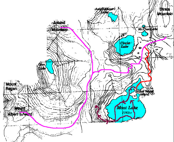
Topographical Map: The route taken by Harold and Joe across Moat Lake
and skirting the edge of Albert Edward is shown with
the lines and purple arrows. That taken by Di and Mic is shown in
Red (on leaving Moat Lake) and then mauve as they
commenced their climb. At one point our lines would only be about 500 yards apart,
separated by a nearly shear cliff.
We then headed back to the camp as Joe and Clinton heading back to Courtney. While I was dissapointed I had not achieved my goal of reaching the summit of Mount Albert Edward, I was satisfied that I had made the best decision and in many aspects, the day had proved to be extremely interesting.
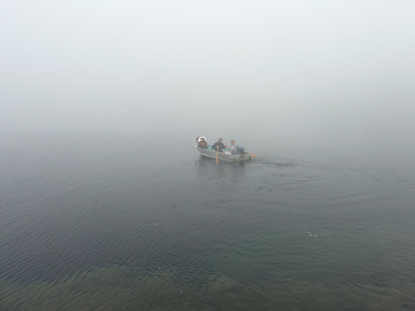 The heavy, low drifting cloud remained and light rain began as Joe and Clinton rowed across the lake. Within a few seconds they disappeared into the white mist. I was worried about Di and Mic so built a fire, made coffee and settled to await their arrival. It had been a long time since I was all alone in the wilderness, many kilometers from the nearest neighbor. It was actually a bit eerie and the mind can play funny games.
Photo: As Clinton and Joe disappear into the fog, I am now left to my own devices as I patiently await the return of Di and Mic.
As 4:00 pm passed the two had now been gone for nearly eight hours and the weather continued to deteriorate. By 5:00 pm, I was downright worried. I decided that if they had not returned by 6:00 pm (about ten hours on the trail), I would send a text to Lynn asking that she alert the area Rangers.
As I had no charger for my phone and only one bar of service, I was worried that I might not have any way of contacting help other than hiking out to the Ranger Station (about 8 kilometers). It was not something I would do after dark as the first two kilometers of the trail was so marked, I could have easily became lost. After spending a bit of time drafting a couple of messages, I settled in to wait. Occasionaly, I would walk to the shore and hollar ‘hellow’ but no answer came back through the heavy fog.
At 6:00 pm, I hit send on my first message which explained the situation to Lynn and three others as I was not sure who might be tuned in to their phone.
Following is the message to Lynn, Kaiya, Clint and Joe as written on my cell:
Msg. #1 “I am worried as di and mi are 3 hours overdue on a six hour trek to Mount Albert Edward from Moat. My guess is they could be lost, perhaps injured between Circlet Lake and Moat. It is cloudy and raining. Talk it over with Rangers and see what would be best. Kaiya, you make the call and see what is best. If no response from Kaiya, Clint or Joe would you make the call.”
 Msg. #2 “I will stay put a Moat and advise if they show up. Trying to preserve power on phone. Please advise if someone receives message and is calling the Rangers. Dianne has her phone with her and was getting some reception.”
The small red exclamation suggested these messages failed, however someone received something as I received a message back simply stating: “Sorry dude, wrong number.”
I then tried shorter messages to Lynn only and she responded advising she had received some garbled information, but understood and would call Search and Rescue.
At 6:25 pm, nearly ten hours after they had left, I saw Di and Mic pulling ashore and immediately sent a short text to Lynn telling her they were safe and sound. Lynn confirmed she would cancelled SAR. I told Di and Mic about my concern and that Lynn had Lynn checked in with SAR. Dianne stated she wanted to contact me but her phone had gone dead while on the mountain. I was just relieved the of them were back safe and sound after having achieved the summit of Albert Edward.
As I had a big fire roaring in the cabin as the wet, amazingly lively trekkers told me about the long and difficult climb. They only met two other hikers, both at the summit, and that is a story I shall let Dianne and Michel take time to explain. During a few breaks in the low lying clouds, they had managed to capture several photographs, before setting about the trecherous descent down the mountain and back to Moat.
I was certainly glad I had decided to stay behind as it had allowed them to accomplish their goal, which it is doubtful would have happened if they had me in two. After a big dinner, a couple of games of crib and more chit chat, we settled in for a good night’s sleep before the trek out.
Link Here for Camp photographs of Day 2
Link Here for Camp Adventure Photographs of Day 2
Link Here for Dianne and Michel’s Summit Hike Only friends of Dianne will be able to complete the link. I will arrange with Dianne to capture her summit photos and place them on an open page.
Day 3: We Bid Farewell to Moat Island and Mount Albert Edward
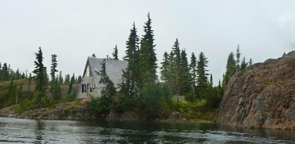
Photo: Taken from watter just off the point of Stuart Wood Island, named, I assume, after the original owner of the property. Our cabin was located on the rock outcropping to the right.
We awoke in the morning to glorious sunshine and cool temperatures as a brisk south westerly blew in off the surrounding ice fields. After getting our gear in order, Dianne patched a nasty little blister on my heel with a bit of mole skin (great stuff, better than duck tape). By 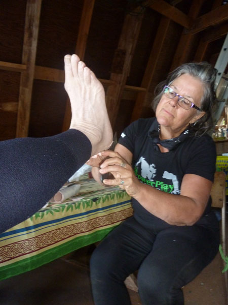 9:00 am we had the cabins cleaned, all the equipment stored as per instructions from Clinton and Joe, then launched the row boat. We were on the Moat trail by 9:30 am.
Photo: A bit of TLC from my baby sister.
Not having experienced that testy ten hour trek of the day before, I was the one feeling frisky after a good helping of oats so Di and Mic let me take the lead. Every half hour I would slow and wait until I heard their voices in the distance, then continue.
Something I have learned again and again, is that for me at least, climbing down is harder than climbing up. It seems to have something to do with my centre of gravity being pushed forward and putting additional pressure on my knee’s. By 12:30 pm my left knee was feeling a slight pinch, so I stopped to grab a bit to eat while Di and Mic caught up.
After we finished lunch, we hit the trail for the last three kilometers to Lake Helen McKenzie. As we slowly lost elevation and entered more heavily forested area, the wind died and the temperature began to rise to near 20 C. When we reached the lake, we decided to stop by and enjoy some time with a few trekking friends that had been constant companions during our time on the trail and at Moat – the Whiskey Jacks.
These lively, friendly birds have become so accustomed to trekkers feeding them along the route, they have lost all concern about the humans in their presence. The attached photos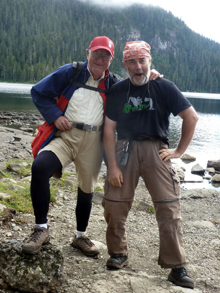 provide a few candid shots as Dianne and Michel have some fun with the Jacks.
Photo: Of course the day would not have been complete without capturing a few fun pictures of Michel and me as we donned our Trapper John dud’s and posed for a few photos.
Once back on the trail, it was simple trekking over the last 3.5 kilometers to the parking lot near Mount Washington. On the drive back, it became clear a good dump of snow had covered the ground the previous day so it was lucky for Dianne and Michel they did not get hit by a snow storm while on the summit.
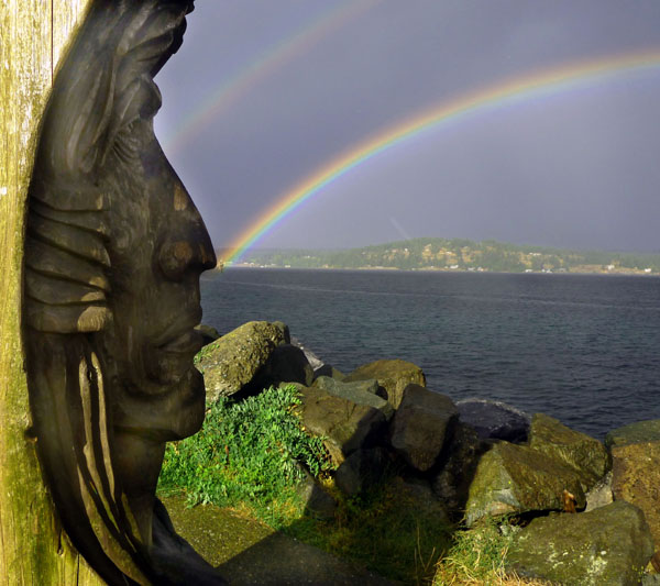
Also, just as we arrived in Campbell River heavy clouds closed in and we were suddenly hit by a torrential downpour that, when it stopped, left an incredibly beautiful rainbow across …. It was an awesome ending to a wonderful trek that was filled with all kinds of a adventure.
My youngest baby sister and her partner are awesome trekking companions and I shall look forward to the next opportunity. Having Lynn along to complete the outing would have been icing on the cake.
Link here for photographs of Day 3
Link here for photographs of the Whiskey Jacks
Cheers,
Harold, Dianne and Michel
Photo: As we savoured a big feed of Fish and Chips along with a cool beer in a small
waterfront cafe in Campbell River, this Rainbow remined us of the wonderful three
days we had spent together.
(1499)
Tags: Clinton Wood, Dianne McNeill , Golden Hind, Harold McNeill, Joe Harper, Lynn McNeill, Michel Payeur, Moat Lake, Mount Albert Edward
Trackback from your site.

Comments (1)